- Posts
- 359
- Likes
- 647
JACK G
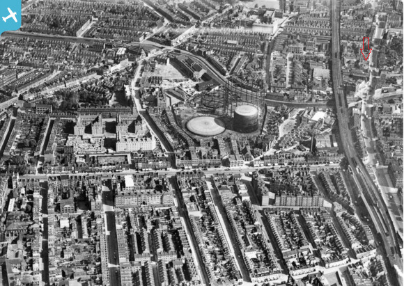
·My wife's mum was born in a house called "The Hollies" 61 Mare Street, Hackney, London which was demolished many years ago. After painstaking research we have managed to identify the exact location - it was on the corner of Mare Street and Bush Road. Bush Road was not built until many years after the house was demolished.
The house was believed to be an old hunting lodge and had cells with chains in the basement.
There were two large Holly bushes in the front garden hence the name "The Hollies".
61 Mare Street is now a modern building housing The Five Points Brewing Company and "The Hollies" would have been on land that was partly the site of the brewery and the rest Bush Road.
We have visited the Hackney Archives, the Hackney Museum and have also been in contact with the Hackney Society who suggests the houses in this area were demolished around 1930 which ties in with my wife's mum's stay there.
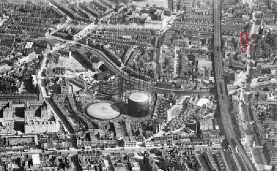
The Hackney Society supplied the map below which we think is c1870 certainly before the railway was built which ran across the middle of the original garden to the house.
We have also established that number 61 on this map is the last large house to the left of the letter 'R' in Mare Street.
At the bottom of the map you can see the word Grove - this is a road called Ash Grove.
No one has been able to help with a picture so any ideas how we could track down a photo or period drawing/painting?

The house was believed to be an old hunting lodge and had cells with chains in the basement.
There were two large Holly bushes in the front garden hence the name "The Hollies".
61 Mare Street is now a modern building housing The Five Points Brewing Company and "The Hollies" would have been on land that was partly the site of the brewery and the rest Bush Road.
We have visited the Hackney Archives, the Hackney Museum and have also been in contact with the Hackney Society who suggests the houses in this area were demolished around 1930 which ties in with my wife's mum's stay there.
The Hackney Society supplied the map below which we think is c1870 certainly before the railway was built which ran across the middle of the original garden to the house.
We have also established that number 61 on this map is the last large house to the left of the letter 'R' in Mare Street.
At the bottom of the map you can see the word Grove - this is a road called Ash Grove.
No one has been able to help with a picture so any ideas how we could track down a photo or period drawing/painting?